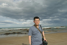
This marks another visit to Flinders Blowhole with Joel before my journey to Taiwan to attend to family matters. During our visit, Joel discovered an additional section of this area, featuring numerous sea caves. We plan to explore them further upon my return from overseas.
The Twelve Apostles, located along the Great Ocean Road in Victoria, Australia, are one of the most iconic natural landmarks in the country. These towering limestone stacks have captivated visitors for centuries, standing as a testament to the immense geological forces that have shaped Australia’s southern coastline. The formation, composition, and ongoing erosion of the Twelve Apostles reveal a fascinating geological history that continues to evolve over time.
Formation and Composition
The Twelve Apostles were formed approximately 10 to 20 million years ago during the Miocene epoch. They are composed primarily of limestone, which is a sedimentary rock formed from the accumulation of marine organisms such as coral, shells, and microscopic plankton. Over millions of years, these organic materials were compacted and cemented together, creating the limestone formations seen today.
Erosional Processes
The striking stacks of the Twelve Apostles are a direct result of erosion processes driven by the powerful forces of the Southern Ocean. The relentless action of wind and waves gradually carved into the soft limestone cliffs, forming caves that eventually deepened into arches. As the arches collapsed, they left behind the isolated rock stacks known as the Twelve Apostles.
Erosion continues to shape the landscape, with the relentless ocean wearing away at the bases of these limestone stacks. This process not only reduces the size of the existing formations but also contributes to the formation of new stacks as sections of the mainland erode and become isolated.
Changes Over Time
Despite the name, there have never been exactly twelve rock stacks. At the time of European exploration, nine stacks were visible, and as of today, only eight remain due to natural erosion. One of the formations collapsed in 2005, demonstrating the ongoing geological changes in the region. The rapid pace of erosion, estimated at approximately 2 cm per year, suggests that more stacks may collapse in the future, while new ones may emerge as sections of the coastline break away.
Geological Significance
The Twelve Apostles provide valuable insights into past marine environments and climate conditions. By studying the limestone formations, geologists can reconstruct historical sea levels, climate fluctuations, and the evolution of coastal landscapes. Additionally, the site serves as an excellent example of coastal erosion and sedimentary rock formation, making it an important location for scientific research and education.
Bridgewater Bay, located in Blairgowrie on the Mornington Peninsula near Melbourne, is a stunning coastal attraction known for its rugged beauty, striking rock formations, and picturesque ocean views. This secluded bay is a favorite among nature lovers, hikers, and photographers, offering a unique blend of natural splendor and adventure.
Natural Beauty and Geography
Bridgewater Bay is characterized by its dramatic limestone cliffs, rocky outcrops, and sandy coves. Unlike the more sheltered beaches on the bay side of the Mornington Peninsula, Bridgewater Bay faces the open ocean, resulting in powerful waves and a constantly changing landscape. The area is shaped by natural erosion, creating fascinating rock pools, sea caves, and arch formations that draw visitors seeking both exploration and relaxation.
Bridgewater Bay is part of the protected ecosystems within the Mornington Peninsula National Park. The region is home to unique flora and fauna, including coastal heathlands and bird species such as the Pacific gull. Conservation efforts ensure that the natural beauty of the bay is preserved while allowing visitors to appreciate its ecological importance.
Here are additional photographs captured at Flinders Blowhole, Mornington Peninsula, where I experimented with varying exposure times to capture the sea's motion. The previous week, the weather was rather unsatisfactory, prompting us to venture into more urban settings. Regrettably, we discovered that most abandoned sites had already been transformed into uninviting concrete structures that nobody desires to inhabit.
Joel is planning to attend yet another concert this Friday. His affinity for death metal has been unwavering, despite his persistent attempts over the years to convert my musical preferences to align with his own. Alas, he has not succeeded, as I remain partial to pop and country music, which does not sit well with him. Consequently, our journeys to various photographic locations often descend into silent disputes, with discussions revolving around politics or science.
Having captured this photograph, Joel and I found ourselves nearly swallowed by the encroaching darkness, standing upon the shallow seabed revealed by the lowest tide. We had ventured nearly a kilometre into the sea on this exposed platform. While capturing sunsets has become a customary practice for me, Joel's thoughts were fixed upon the prospect of indulging in the fried prawns at a nearby fish and chips establishment following our photographic endeavor.
This picturesque spot is perfect for anyone looking to connect with nature, breathe in fresh sea air, and soak up the tranquil vibes.
During sunrise and sunset, the jetty transforms into a canvas of breathtaking colors, reflected beautifully on the calm waters below. It's a haven for photographers, artists, and anyone who appreciates the simple beauty of nature. The jetty is also a fantastic spot for fishing enthusiasts, offering a peaceful setting to cast a line and potentially catch a variety of local fish.
Returning to laborious pursuits after the festivities is indeed arduous. Behold this image, captured upon a blustery day, the sea roiling with tempestuous swells. The melancholic ambiance of the scene is rather striking to me.
Just an hour's drive northwest of Melbourne, lies the enigmatic Hanging Rock. This awe-inspiring geological formation, rising majestically from the Macedon Ranges, has captivated the imagination of visitors for centuries.
A Geological Marvel
Hanging Rock, or Mount Diogenes as it is formally known, is an extraordinary rock formation made up of volcanic magma that solidified around 6.25 million years ago. Its unique pinnacles and sheer cliffs create an otherworldly landscape that is perfect for exploration and adventure. The rock stands 718 meters above sea level and offers breathtaking panoramic views of the surrounding countryside.
Cultural Significance
Hanging Rock holds a special place in the hearts of the local Indigenous Wurundjeri people, who regard it as a sacred site. The area is steeped in rich cultural history and tradition, making it a meaningful destination for those interested in Australia's Indigenous heritage.
Picnic at Hanging Rock
The mystery and allure of Hanging Rock were immortalized in Joan Lindsay's 1967 novel "Picnic at Hanging Rock," and the subsequent 1975 film adaptation directed by Peter Weir. The story, centered around the unexplained disappearance of a group of schoolgirls and their teacher, has added an air of intrigue and mystique to the site, drawing countless visitors keen to experience the setting of the iconic tale.
On New Year's Day, finding ourselves rather bored, Joel and I decided to explore this area, while everyone else frolicked at the beach.
Rapid Bay's jetty was originally constructed in 1942 to facilitate limestone mining operations. However, as the years passed and industrial needs changed, the once bustling jetty was abandoned in favor of a newer, more modern structure. Today, it stands as a hauntingly beautiful relic of the past, with its skeletal remains stretching out into the turquoise waters of the bay.
This forgotten jetty has become a magnet for those seeking adventure off the beaten path. Divers flock to its underwater world, where schools of fish, colorful coral, and sometimes even the elusive leafy sea dragon can be spotted amidst the submerged pylons. For photographers, the jetty offers an endless canvas of rustic beauty. Each visit reveals a different facet, from the play of light and shadows to the dramatic backdrop of rolling waves and sunsets that paint the sky in hues of orange and pink.
Rapid Bay is a hidden gem just 105 kilometers south of Adelaide. This tranquil seaside town is known for its stunning coastal scenery, including long sandy beaches, towering cliffs, and crystal-clear turquoise waters.
One of the highlights of Rapid Bay is its historic jetty, which offers breathtaking views of the bay and is a popular spot for fishing and relaxation. The bay is also a haven for divers and snorkelers, with dramatic shipwrecks and vibrant marine life, including the elusive Leafy Sea Dragon.
For those who love exploring, Rapid Bay's coastal caves and scenic hiking trails provide endless opportunities for adventure. The area is perfect for a peaceful getaway, whether you're camping under the stars or enjoying a picnic by the shore.
Joel and I took a long drive to reach this destination. Not much else is there apart from droning.
The Geology of Pink Lake
Pink Lake’s iconic pink color and its unusual salt crust have sparked scientific interest, and its geology is just as captivating as its history.
The Formation of the Lake
Pink Lake is a saline lake, which means it is highly concentrated with dissolved salts. The lake itself is part of the Eyre Basin, a large endorheic basin in South Australia. Endorheic basins are unique because they don’t drain into the sea, which results in the accumulation of water, salts, and minerals over time. The lake was formed through a combination of ancient geological processes, including the movement of tectonic plates, as well as climatic factors such as evaporation and rainfall patterns.
Over millions of years, the region's climate has fluctuated, with periods of both wetter and drier conditions. During drier times, the lake has dried up, leaving behind a thick layer of salt. When filled with water, the lake remains highly saline due to the evaporation that occurs in the hot, dry conditions of South Australia. This process of evaporation leads to a concentration of salts, and the lake’s high salinity is what supports the formation of salt crusts on its surface.
The Pink Color Phenomenon
The stunning pink hue of Pink Lake is one of its most distinctive features. The color of the lake can vary in intensity, from pale pink to deep fuchsia, and is influenced by several factors, most notably the presence of specific microorganisms in the water. A key contributor to this coloration is a type of algae known as Dunaliella salina, which thrives in highly saline environments. This algae produces a red pigment called beta-carotene, which is responsible for the lake's signature pink appearance.
In addition to the algae, the lake’s unique chemistry also plays a role in the color change. High levels of salt in the water create an environment where certain types of bacteria and microorganisms flourish, leading to the vivid color shifts. The lake's color can also be affected by the time of year, temperature, and the water’s salt content, which explains why the lake’s appearance can change from one season to another.
Salt Production and Mining
Over the years, salt mining has been a significant part of the lake's economic history. The salt extracted from Pink Lake is high in quality, and it was used in a variety of applications, from table salt to industrial and agricultural uses. In the past, large-scale mining operations have extracted salt using evaporation techniques, where water from the lake was allowed to evaporate, leaving behind a thick, white salt crust.
Today, salt production at the lake has mostly ceased, but remnants of the industry remain. The area is still an important site for scientific study, particularly concerning its saline ecosystem and the unique microorganisms that call the lake home.
It was a good catch up with Joel for his birthday dinner celebration. We had black lip abalone on 80th floor in CBD. We drank so much spirits and sake. Now I am hanged over.
Joel and I did not manage to walk far into Balcombe walking trail. He was so preoccupied with this scene. He set up his equipment like he was setting up a nuclear lab. It only took less than 1 minute to get this frame handheld.
Mount Martha is a quaint beach town wedged between Safety Beach and Mornington on the Mornington Peninsula. This is a popular walk with locals and it's easy to see why - this track follows the Bay Trail and encompasses four leash free beaches as well as providing beautiful bay views.
Hawker Beach, Birdrock Beach and Dava Beach are three different leash free beaches available along this walk and all boast golden sand and clear water. Your dog will love jumping through the waves or digging in the sand and owners will love the shelter of the surrounding cliffs – creating your own sanctuary. Make sure you are aware of the steep beach access along this walk
The leash free beaches are expansive, with Dava Beach being a continuation of Birdrock Beach (the only way to enter Dava Beach is to first enter Birdrock Beach). Fossil Beach gives you something different altogether, being predominately made up of rocks it gets its name from the abundance of fossils that geologist A.R.C Selwyn discovered amongst the limestone cliffs there in 1854. These fossils displayed evidence of sea life from 10-15 million years ago.
Hualien is the meeting point of the Central Cross-Island Highway, Suao-Hualien Highway, and highways leading south to Taitung.
Hualien County is home to several world-class scenic attractions. In 1590, Portuguese sailors passed by the eastern coast of Taiwan and were so moved by the grandeur of what they saw that they named this land "Formosa," the beautiful island. Since that time, the majestic views of Hualien have come to represent Taiwan.
Formerly known as Qilai, Hualien's current name derives from the phrase "huilan" (eddying water), a reference to the swirling currents of the Hualien River where it meets the sea.
Hualien is Taiwan's biggest county, with an area of about 4,628 square kilometers and a population of 350,000. The county borders the Pacific Ocean to the east and is hemmed in by the Central Range to the west. With its towering peaks, azure skies, vast seas, scenic valleys, cultural diversity, and friendly kindhearted people, Hualien has become one of Taiwan's first-choice travel destinations for local and international visitors alike.
There are some 200 after quakes after the initial one 1 month ago. I am not planning to go anywhere near the location now.
This area is called the petrified forest from an early theory that advancing sand engulfed an ancient forest of coastal trees that once covered the sea cliff, petrifying them for all time.
Actually the formation is a collection of hollow tubes of limestone called “solution pipes”, eroded by millions of years of rainfall. The process starts when water gathers in a shallow pan of sand and seeps downwards dissolving the limestone. The mineral saturated water then cements the sand, forming hard, trunk-shaped pipes. Most pipes around Cape Bridgewater are only three metres high, although some are as much as twenty metres.
The Petrified Forest is easily accessible from the car park at the end of Blowholes Road, Cape Bridgewater.
I have been to this area 4 times in total. This is the most recent snap.