Showing posts sorted by relevance for query beach. Sort by date Show all posts

Thursday, December 26, 2024

Safety Beach Sunset for Water H2O Thursday


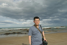
Safety Beach is a serene seaside suburb just 56 km (35 miles) south of Melbourne's Central Business District. Known for its calm, sandy bay and family-friendly atmosphere, Safety Beach is a perfect spot for a relaxing day by the water.

A Beach for Everyone Safety Beach offers a safe swimming environment, making it ideal for families with young children. The beach is protected by a cove, ensuring calm waters and a gentle surf. There's also a small sandy dog beach, so you can bring your furry friend along for some fun in the sun.

Activities and Amenities The foreshore reserve features an attractive children's playground, BBQ areas with shading, and plenty of picnic spots. For those who enjoy boating, Martha Cove, a large inland harbour, provides excellent facilities and scenic views. The Safety Beach Sailing Club, established in 1967, hosts numerous state and national titles, showcasing the area's vibrant sailing community.

Scenic Surroundings Safety Beach is surrounded by natural beauty, with views of Mount Martha to the north and Arthurs Seat to the south. The coastal road of Marine Drive separates the housing and commercial areas from the beach, offering a scenic drive with stunning ocean views.

Historical Tidbits Interestingly, Safety Beach was once humorously referred to as "Shark Bay" due to shark sightings attracted by an old abattoir's waste. However, the area has since been cleaned up, and the name "Safety Beach" remains


Sony A7RV

FE 70-200mm f4 G

Linking Water H2O Thursday


Thursday, June 27, 2024

Mount Martha sunset Mornington Peninsula for Water H2O Thursday


Joel and I did not manage to walk far into Balcombe walking trail. He was so preoccupied with this scene. He set up his equipment like he was setting up a nuclear lab. It only took less than 1 minute to get this frame handheld.

Mount Martha is a quaint beach town wedged between Safety Beach and Mornington on the Mornington Peninsula. This is a popular walk with locals and it's easy to see why - this track follows the Bay Trail and encompasses four leash free beaches as well as providing beautiful bay views.

Hawker Beach, Birdrock Beach and Dava Beach are three different leash free beaches available along this walk and all boast golden sand and clear water. Your dog will love jumping through the waves or digging in the sand and owners will love the shelter of the surrounding cliffs – creating your own sanctuary. Make sure you are aware of the steep beach access along this walk 

The leash free beaches are expansive, with Dava Beach being a continuation of Birdrock Beach (the only way to enter Dava Beach is to first enter Birdrock Beach). Fossil Beach gives you something different altogether, being predominately made up of rocks it gets its name from the abundance of fossils that geologist A.R.C Selwyn discovered amongst the limestone cliffs there in 1854. These fossils displayed evidence of sea life from 10-15 million years ago.

Sony A7RV

FE 70-200mm f4 G

Linking Water H2O Thursday


Friday, January 17, 2025

Kilcunda panorama for Sky Watch Friday


Kilcunda Beach offers a serene and breathtaking escape for nature enthusiasts and beach lovers alike. Known for its stunning vistas, rugged coastline, and diverse marine life, this idyllic destination is a must-visit for those seeking tranquility and natural beauty.

Kilcunda Beach, located approximately 115 kilometers southeast of Melbourne, boasts expansive sandy shores that invite visitors to relax and unwind. The gentle waves lapping against the shore create a soothing soundtrack, perfect for those looking to escape the hustle and bustle of city life. The beach's unique combination of rocky outcrops and sandy stretches provides a picturesque backdrop for photographers and artists.

One of the highlights of Kilcunda Beach is the Kilcunda Rail Trail, a scenic walking and cycling path that offers panoramic views of the coastline. The trail, which follows the route of an old railway line, provides an opportunity to explore the area's rich history while enjoying the natural beauty that surrounds it. The iconic Kilcunda Trestle Bridge, a historic landmark along the trail, is a popular spot for taking in the stunning vistas and capturing memorable photographs.

Kilcunda Beach is also renowned for its rich marine life, making it a popular destination for fishing and snorkeling. The rock pools along the shoreline are teeming with diverse marine species, offering a fascinating glimpse into the underwater world. For those who enjoy fishing, the beach's clear waters provide an excellent opportunity to catch a variety of fish, including salmon, snapper, and trevally.


Linking Skywatch Friday


Friday, May 23, 2025

Balnarring Beach, Mornington Peninsula for Skywatch Friday


In the first photograph, Joel is visible in the distance, intently focused on photographing seaweed along the shoreline. The air has grown markedly cooler, and the sky bears the pale, steely blue that signals the quiet approach of winter. It is in such moments that the necessity of reconnecting with the natural world becomes most apparent—calming, grounding, and essential to the soul.

Balnarring Beach, located on the Mornington Peninsula southeast of Melbourne, stretches along the calm waters of Western Port Bay. Its gentle crescent shape and serene outlook toward Phillip Island make it a place of both quiet retreat and natural charm. The area is known for its safe swimming waters, expansive foreshore reserves, and the peaceful rhythm of tidal life.

The name “Balnarring” is thought to originate from Indigenous words meaning “little” and “gumtree,” a poetic nod to the native landscape. European settlement began in earnest in the 1840s when pastoral stations were established, and by the latter half of the 19th century, Balnarring had grown to include a post office, a school, and a church. The arrival of the railway in the early 20th century further connected the township with surrounding areas, allowing more visitors to discover its coastal beauty.

Balnarring Beach—once also known as Tulum Beach—has long held a quiet reputation as a haven for holidaymakers and nature lovers. In more recent times, it was honoured as one of Australia's cleanest beaches, a testament to the community's stewardship and respect for the land.

Even as seasons shift and the cold edges in, Balnarring Beach remains a place of stillness and reflection—a coastal landscape where history, nature, and memory meet in tranquil harmony.


Sony A7RV

FE 20-70mm f4 G


Linking Skywatch Friday


The past fortnight has been exceedingly busy for me. Despite the considerable amount of work I have undertaken, the returns have felt rather meagre. Joel and I have been diligently studying investments in the Japanese stock market, prompted by Warren Buffett’s decision to reallocate his wealth into Japanese equities.


Sunday, December 7, 2025

No16 Beach in Rye for Sunday Best


No. 16 Beach in Rye is known, of course, for its Dragon Head Rock — that craggy silhouette rising from the restless sea like an ancient sentinel carved by wind and tide. Yet it is not only the famous formation that holds the eye. What fascinated me more that day was the exposed ocean floor, revealed in shifting patches as the waves inhaled and exhaled. Ridges of kelp, stone, and sand emerged like the ribcage of the earth itself, each glistening plate a quiet record of centuries of tides, storms, and moonlit nights. Here, the sea writes its diary in saltwater ink.

Joel and I lingered on the shoreline, lingering in the breeze that smelled of brine and age. Our footsteps pressed into sand that had once been sacred to the Boon Wurrung people, the traditional custodians of this stretch of the Mornington Peninsula. For thousands of years they moved along these windswept dunes and coastal flats, gathering shellfish, watching the migration of birds, reading the tides with an intimacy that modern visitors can only imagine. Long before the beach became a photographer’s haven, it was a living classroom, a place of food, ceremony, and story.

Later came the early European settlers, carving tracks through the tea-tree, building fishing huts, and naming the headlands after their own imaginings. The coastline remained wild and ungovernable, storms reshaping its contours with a kind of untamed artistry. Dragon Head Rock itself became a marker for sailors and wanderers — a creature hewn from basalt, watching over the changing generations.

As Joel and I took in this layered landscape, the unexpected happened: a photography group we had once been part of — a group with which the past included frictions and small wounds — wandered into the same stretch of beach. The air, suddenly, felt taut. Once, we had met weekly under the casual banner of shared interests, but the structure frayed when the leader, who struggled with memory impairment, continued to collect a five-dollar annual membership fee as if time had not moved on. Misunderstandings grew. Intentions tangled. A minor sum became a symbol of something heavier — a discomfort none of us knew quite how to name.

Seeing them again here, the old tension rose like a shadow across the sand. Yet it was oddly softened by the scenery. The roar of the waves seemed to dwarf the awkwardness, reminding us that human discord is fleeting compared to ancient coastlines. Dragon Head Rock did not care for our quarrels. The exposed ocean floor continued its shimmering revelations, indifferent to the knots of memory and missteps that people carry.

In that moment, the past felt like another tide — rushing forward, pulling back, reshaping what we thought we understood. And the beach, wise and wide as ever, held all of it: the history of land and water, the footprints of those who came before, and the small human stories that drift through like foam on the surface of a much older sea.


Sony A7RV

FE 20-70mm f4 G


Linking Sunday Best


Sunday, December 29, 2024

Childer's Cove for Sunday Best


Childers Cove is a small, crescent-shaped beach framed by rugged cliffs and dramatic rock formations. The towering limestone cliffs, reaching up to 70 meters (230 feet) above the turquoise waters, create a natural amphitheater showcasing the raw beauty of the coastline. The beach itself is low and flat, with a shallow bay floor, making it ideal for a leisurely stroll or beachcombing.

The cove holds a poignant history as the site where the wooden barque "Children" was wrecked after striking reefs close to shore in 1839. Despite its somber past, the cove exudes a unique charm, inviting visitors to explore its untouched serenity.

Childers Cove is not just a beach; it's an ecosystem teeming with life. Keep an eye out for inquisitive penguins waddling on the shore, listen to the melodic calls of seabirds soaring overhead, and spot playful dolphins dancing in the waves. The diverse flora, including coastal shrubs, wildflowers, and native grasses, adds to the vibrant backdrop of this scenic sanctuary.

From the golden hues of sunrise painting the cliffs to the dramatic silhouettes at sunset, Childers Cove is a photographer's dream. Capture the raw power of the ocean crashing against the rocks, the playful frolicking of dolphins, or the serene atmosphere of the secluded beach.

Childers Cove is accessible via a well-maintained gravel road located off the Great Ocean Road, near Nullawarre. Limited parking is available near the beach, and toilet facilities can be found at the nearby Murnanes Bay car park. Remember to be sun-safe and bring appropriate footwear for exploring the rocky terrain.

Escape the crowds, breathe in the fresh ocean air, and immerse yourself in the tranquility of this unspoiled paradise. Whether you're a history buff, nature enthusiast, or simply seeking a relaxing retreat, Childers Cove offers something for everyone


Sony A7RV

FE 20-70mm f4 G

Linking Sunday Best


Friday, September 26, 2025

No 16 Beach, Rye for Skywatch Friday


Upon the evening of my visit to Number Sixteen Beach at Rye, the heavens lay utterly cloudless, and the setting sun cast its mellow radiance across the waters. Though this stretch of coast is among the most frequented along the Mornington Peninsula, fortune granted me solitude; not a soul was present to disturb the tranquillity. The waves, breaking upon the sand with unhurried constancy, left a delicate froth in the foreground, a lacework of the sea that I found singularly pleasing.

Number Sixteen Beach, so named after the original trackway once marked by numbered posts guiding visitors through the dunes, has long held a reputation both for its rugged beauty and its perilous seas. Unlike the sheltered bay beaches of Rye, this ocean front faces the Bass Strait, and its powerful surf has made it a place admired by walkers and naturalists rather than a safe haven for swimmers. The limestone cliffs and rock platforms that frame the beach bear silent testimony to the restless shaping hand of wind and tide through countless ages. In former times, the local Bunurong people knew these coasts intimately, gathering shellfish from the rock shelves and reading in the land and waters the signs of season and story.

Thus, standing alone at sunset, with the waves whispering their endless song, one is not merely a solitary observer of beauty but also a quiet inheritor of a long continuum of human presence, reverence, and memory upon this shore.


Sony A7RV

FE 14mm f1.8 GM


Linking Skywatch Friday


Sunday, September 28, 2025

Wreck Beach Moonlight Head Beach for Sunday Best


Joel and I have journeyed to Wreck Beach on three occasions, each visit impressed upon us by the austere beauty and the peril of that lonely shore. Remote and forbidding, it is a place where the turbulent Southern Ocean pounds without respite, and where the rising tide swallows the sands entirely, climbing high against the sheer cliff faces and leaving no safe passage.

The path thither is no easy one. A descent of more than three hundred steps leads to the long strand, and from there the traveller must endure a walk of nearly five kilometres along soft and yielding sand, each step burdened by the pull of the sea winds. Yet at the end lies a solemn reward: the scattered relics of wrecks long past, anchors and iron fastenings now half-buried in stone and seaweed. These are the remnants of the Marie Gabrielle, driven aground in 1869, and of the Fiji, lost to these merciless waters in 1891. Once proud ships upon the trade routes, they met their fate here, on a coast that mariners dreaded and named a graveyard.

I have shared images of this place twice before, but in revisiting my photographs I felt compelled once again to dwell upon its memory. Wreck Beach is more than a strand of sand—it is a living monument to history, where the power of the sea and the fragility of man’s endeavour stand forever in stark and solemn contrast.


Panasonic G9

Olympus 17mm f1.2 


Linking Sunday Best


Thursday, October 16, 2025

Bore Beach San Remo at Gippsland for Water H2O Thursday


My apologies in advance — over the coming weeks, my posts will be devoted entirely to the seascapes of this beloved coast. I find quiet joy in the short drive and in the patient search for light, texture, and tide along its edge.

Bore Beach at San Remo carries a history woven deep into Victoria’s maritime past. Once part of a rugged fishing and trading route, it served as a working shoreline where boats were launched into the often restless waters of Bass Strait. In the late nineteenth century, the nearby township of San Remo grew around the bridgehead that linked the mainland to Phillip Island, becoming a small but vital port for granite, coal, and the island’s dairy produce. Local fishermen would gather at Bore Beach before dawn, their lanterns swaying like low stars, setting out to sea for snapper and salmon.

Today, the beach remains quieter — its industry replaced by contemplation. The wind carries only traces of those early voices, mingling with the cry of gulls and the rhythmic pull of the tide. To wander here is to feel both the endurance of the sea and the fragile beauty of human memory along its shore.


Sony A7RV 

FE 20-70mm f4 G


Linking Water H2O Thursday


Sunday, January 19, 2025

Second Valley Beach, South Australia for Sunday Best


Second Valley Beach is frequently promoted as an ideal family-friendly destination. Upon our arrival, Joel's immediate observation was its diminutive size, referring to it as a "small, tiny, puny beach!" Nevertheless, the area was teeming with visitors, seemingly more people than sand. The beach featured an abandoned jetty and a distinctive belt of unusual rock formations extending away from the shoreline. Fortunately, the tide was low, allowing us to safely traverse the narrow, stony trail leading to the rocky outcroppings.


Sony A7RV

FE 20-70mm f4 G

Linking Sunday Best

In the past few days, I have completed viewing the second season of "House of Dragons," watched two horror films while exercising on the elliptical machine, and watched the movie "Sleeping Dogs." As a result, I feel thoroughly entertained.


Friday, August 22, 2025

Magic Beach Cape Woolamai Phillip Island for Skywatch Friday


Magic Beach, revealed only at low tide along the sweeping shores of Cape Woolamai on Phillip Island, is a place where the natural and the personal converge in quiet wonder. When the ocean withdraws, the sea floor unveils a scatter of ancient rocks, their surfaces carved and smoothed over millennia by waves and wind. These formations are the remnants of a powerful volcanic past, for Cape Woolamai itself is born of basaltic flows and granite intrusions that date back millions of years, their rugged cliffs now standing sentinel over Bass Strait. Long before European arrival, this coastline formed part of the lands of the Bunurong people, who knew its rhythms of tide, bird, and season. Today, it remains both a sanctuary for migratory seabirds and a dramatic landscape that draws the eye and stirs the imagination.

It was here, during the pandemic year when Melbourne lay under lockdown, that I came alone with my newly acquired Sony A7RIV, predecessor of the A7RV, eager to explore its capabilities. Magic Beach seemed an apt stage for such an experiment. I found myself entranced by the interplay of light and shadow across tide pools and rocks, using HDR techniques I had never attempted with my earlier Panasonic or Canon cameras. The solitude of that moment—an island shore, a receding tide, the silence broken only by surf—transformed the practice of photography into something almost meditative. In that fleeting communion, I glimpsed both the deep history of Cape Woolamai and the personal magic of discovery, as if the land itself conspired with my lens to etch memory into image.


Sony A7RIV

FE 16-35mm f2.8 GM

Linking Skywatch Friday


Saturday, July 23, 2022

No 16 Back Beach Mornington Peninsula, Melbourne


Love the spot behind Dragon Head No 16 Rye beach in Mornington Peninsula 


Sony A7RIV 

FE 14mm f1.8 GM


Beach posts

The intense blue is particularly nice in Winter 

Not good for my wet feet


p.s. The spam filter on blogspot is a nightmare. I cannot even comment on other blogs anymore. I even struggle to get inside this blogspot. This reminds why I left Blogspot 5 years ago. PTSD!

Tuesday, May 7, 2013

Lake Bunga, Gippsland


This was a fresh water lake near Lake Entrance, Victoria. In fact, this beach was much nicer than Nnety Miles Beach off Lake entrance beach walk way.

Olympus 12mm f2 rendered the rich colour and refreshing feeling of the day!

Joel and I had a good weekend.

Friday, September 19, 2025

Portsea Beach, Mornington Peninsula for Skywatch Friday


This steadfast rock has ever been my compass for long exposures, a sentinel against the shifting tides and the passing of seasons. Last weekend the heavens conspired with storm and rain, and so I turned from the unruly present to the stillness of my archives, where calmer skies and gentler seas remain preserved.

Portsea Beach itself is a place where time and tide weave their eternal dance. The cliffs and outcrops, born of sandstone and limestone laid down in forgotten oceans, stand weathered yet unyielding, their faces etched by centuries of wind and wave. Each stone bears the script of ages, each ripple of sand a fleeting verse upon the vast poem of the shore.

Here the sea gathers its strength, for the Southern Ocean presses against the narrow Heads, surging into Port Phillip Bay with a restless spirit. The waters may gleam like glass beneath a quiet dawn, yet within them lies the memory of tempests, of ships dashed and lives claimed. Beneath it all, the Bunurong people once walked these sands with reverence, their footsteps bound to the rhythm of tide and season, reading the coast as one might a sacred text.

To stand upon Portsea Beach is to linger at the threshold of worlds—the ancient and the present, the serene and the perilous. It is a place where nature holds dominion, and where the solitary rock, enduring amid the breakers, becomes not merely a subject for the lens but a symbol of patience, memory, and the silent grandeur of the sea.

Sony A7RV

FE 20-70mm f4 G


Linking Skywatch Friday


Friday, May 2, 2025

Second Valley Beach, South Australia for Sky Watch Friday


Second Valley Beach in South Australia is a hidden gem, known for its rugged cliffs, crystal-clear waters, and peaceful ambiance. I was lucky to visit the beach on a cloudless day, when the sky stretched endlessly above in a perfect, uninterrupted canvas of blue. Everything was sheer blue—the sky, the ocean, even the reflections dancing on the rocky shoreline. The calm, gentle waves lapped against the shore as if time had slowed down just for that moment. It was a serene experience, where nature's beauty felt both overwhelming and calming all at once.


Sony A7RV

FE 20-70mm f4 G

Linking Skywatch Friday


Thursday, June 19, 2025

Montforts Beach Sunset Mornington Peninsula for Water H2O Thursday


Montforts Beach, nestled along the wild and windswept southern coast near Melbourne, remains one of the few coastal enclaves where photographers may still pursue the elusive golden hour even during the rise of high tides. This hidden gem, rarely frequented due to its seclusion, offers a dramatic tableau of nature’s enduring craftsmanship. Towering cliffs of ancient sandstone, layered with millennia of geological memory, descend into tessellated basalt formations—remnants of long-extinct volcanic activity that once shaped the Mornington Peninsula. The beach itself, a narrow strip of coarse golden sand, lies hemmed in by rock pools, tidal shelves, and kelp-strewn shallows, all bathed in the shifting hues of the setting sun.

Yet the approach to this remarkable place has grown increasingly difficult. What was once a discernible trail has, in recent seasons, been overtaken by vigorous coastal vegetation. Low-hanging tea-trees twist and arch over the track, their limbs heavy with salt-laden air, while dense undergrowth of banksia, bracken, and coastal wattle obscure the path beneath. The bush seems to reclaim the land with a quiet persistence, and each step forward requires both care and instinct.

On this most recent journey, Joel and I found ourselves disoriented amid the overgrowth. The once-familiar route seemed to vanish into the thicket, and we moved forward more by memory and determination than by sight. Despite the hardship of the passage—scratched limbs, uncertain footing, the whisper of the wind bearing no answer—we pressed on, compelled by the promise of what lay beyond. And at last, as the trail opened up to the vast, moody expanse of sea and stone, we were reminded why Montforts remains, for all its resistance, a sacred haunt of light and solitude.


Sony A7RV

FE 20-70mm f4 G

Linking Water H2O Thursday


Friday, January 6, 2023

Mornington Peninsula Back Beach for Skywatch Friday


Last few days strolling along the beach was nice. The temperature actually came down too. more bearable. This is so good that I do not need to stress over anything in the holiday mood.


Sony A7RV

FE 16-35mm f2.8 GM


Linking Skywatch Friday


Friday, September 12, 2025

Flinders Blowhole Beach in Mornington Peninsula for Sky Watch Friday


This stretch of beach was where I often wandered in search of crabs hiding in the rock pools, timing my steps just before the sun began to sink low over the horizon. The tide left behind pockets of still water that mirrored the sky and, most strikingly, the cave nearby whose reflection shimmered with the changing light. It was a fleeting but beautiful moment, where the ordinary act of looking into shallow puddles revealed both life and landscape in harmony.

The cave and blowhole are part of the rugged coastline at Flinders, on the southern edge of the Mornington Peninsula, about an hour and a half from Melbourne. The region tells a story that stretches back millions of years, when volcanic activity left behind the dark basalt cliffs that now meet the sea. Over time, the powerful swells of the Bass Strait relentlessly carved into these rocks, hollowing out sea caves and forming the blowhole that today draws both visitors and locals. The air there often carries the salt spray of crashing waves, and on windy days the ocean surges with a force that reminds you of its timeless authority.

Flinders itself has long been appreciated for its natural beauty, with its cliffs, rock shelves, and tide pools offering endless opportunities for exploration. Beyond its geology, the area is steeped in human history too: the coastline was known and traversed by the Bunurong people, who relied on its waters for food and held deep connections to its land and sea. Later, it was named after the navigator Matthew Flinders, who charted much of Australia’s southern coast in the early 1800s.

Standing at the blowhole today, watching the sun lower across the horizon and catching glimpses of crabs in the pools, I felt the convergence of many timelines. The fleeting moment of a reflection in water was layered atop a landscape shaped by fire and ocean, and upon traditions that stretch back thousands of years. In that sense, the Flinders Blowhole is not only a place of natural drama but also one of quiet continuity, where the vastness of history meets the intimacy of memory.


Sony A7RV

FE 20-70mm f4 G

Linking Skywatch Friday


Thursday, February 15, 2024

Magic land in Cape Woolamai Surf Beach for Water H2O Thursday


The rising tide is invading the beach Joel and I are walking on. Every 10 minutes, a large wave comes up a few more metres onshore. The receding water looks mesmerising. 


Sony A7RV

FE 20-70mm f4 

Linking Water H2O Thursday


Friday, March 14, 2025

Tenby Point Reverse Sunset for Skywatch Friday


Tenby Point is a small coastal village located in the Bass Coast Shire of Victoria, Australia, nestled along the eastern shoreline of Western Port Bay. Geographically, it lies east of Corinella, northeast of Coronet Bay, and southwest of Grantville. The village is characterized by its linear layout, comprising four main streets: Guy Road along the southern boundary, Bayview Avenue extending through the town, Marine Parade to the north, and Park Lane on the western side. As of the 2016 census, Tenby Point had a population of 184 residents.


The coastal landscape surrounding Tenby Point is notable for its alternating headlands and embayments, backed by active cliffs and bluffs formed from the Baxter Formation. This geological structure contributes to the area's dynamic shoreline, where headlands intercept the eastward drift of beach materials, leading to the formation of temporary cuspate forelands and recurving spits. These features highlight the ongoing processes of coastal erosion and sediment deposition that have shaped the region over time.

A significant historical landmark in Tenby Point is the remnants of an old jetty, visible along the beach. While specific historical records detailing the jetty's construction and usage are limited, such structures were commonly built in coastal Australian towns during the late 19th and early 20th centuries to facilitate maritime activities, including transportation of goods and fishing. The presence of these remnants offers a tangible connection to the village's past interactions with maritime trade and local industry.

The broader region encompassing Tenby Point has a rich history tied to early European exploration and settlement. The adjacent town of Corinella, for instance, was established in 1826 as a military outpost, serving as one of Victoria's earliest European settlements. This outpost aimed to deter French territorial claims and to establish a strategic presence in the area. Although the settlement was short-lived, it marked the beginning of European interest and subsequent development in the region.

Today, Tenby Point remains a serene residential area, appreciated for its natural beauty and tranquil environment. The village's coastal setting and proximity to other towns in the Bass Coast Shire make it a modest yet integral part of the region's tapestry, reflecting both its historical roots and ongoing connection to the maritime landscape.

Sony A7RV

FE 70-200mm f4 G

Linking Skywatch Friday and Blau - die Farbe des Monats März